Longfellow Creek: 24th Ave SW Street and Creek Design
Longfellow Creek runs through the Delridge Community in West Seattle. In some areas, this creek is a lush natural area enjoyed by people and wildlife including birds, muskrat, beaver, and more. It is also the second largest salmon-bearing creek in Seattle. But as West Seattle was developed, many parts of Longfellow Creek were sent underground or into narrow ditches.
Neighborhood Challenges
Decades ago, the creek was straightened into a narrow channel along one block of 24th Ave SW, between SW Graham St and SW Willow St. Partly as a result, the neighborhood has been experiencing a number of issues:
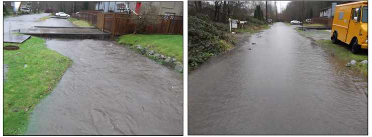
Frequent flooding caused by the channel being too narrow — especially under driveways and roads — as shown in these photos from 2007. The flooding keeps emergency vehicles — and residents — from accessing homes on the street.
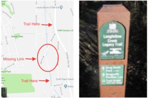
Confusing and unsafe public walkway. The Longfellow Creek Legacy Trail, which extends both upstream and downstream from this block, disappears on this block. To get from one trail to another, walkers throughout the community are forced to walk in the street or in private yards, and through the unsafe intersection of 24th and 25th Ave SW.
Erosion of the stream-banks — which, in cases like the one to the right, is actually the front yard of a homeowner. Not only does this make residents nervous about their houses being in danger, but it’s not good for the creek.
Coming Together for a Solution
Some of the neighbors on the block decided to take action to fix these problems. They formed the 24th Ave SW Community Leadership Committee, determined to develop a plan that would address multiple problems with their street. The neighbors partnered with Mid Sound Fisheries Enhancement Group to obtain several grants to support the project.
With this support, we worked to explore the options for the street and stream design and then reach out to a broad section the community for advice. We wanted to come up with a design that will work best for everyone.
Together, we are working to develop a plan that reduces flooding, provides better stream habitat, addresses runoff, and connects the trail.
We are pleased to be working with an advisory group composed of a number of representatives from agencies within the City of Seattle — including Seattle Parks and Recreation, Seattle Public Utilities, Seattle City Light, and Seattle Department of Transportation. These experts are helping us to ensure that the plan developed is feasible, is in line with their vision for Parks and infrastructure improvements, and will be eligible for construction funding in the future.
Getting Community Input
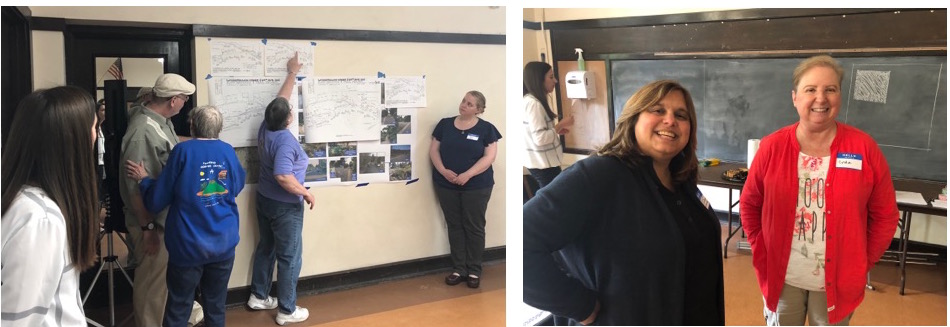
We held several community meetings to get input from neighbors, local biking enthusiasts, and others interested in the trail or stream health.
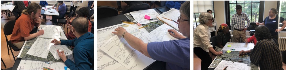
At the first community meeting on June 7th, 2018 attendees learned about the project and started the first step of the process — imagining what elements of the conceptual design could include.
They were given schematics of the street and colored pencils then asked: where would you put the street, creek, and trail if you could move them and cost was no object? The attendees took to the activity let their imaginations fly — drawing in a roundabout, making the street curve, cantilevering a trail above parts of the creek, and more!
The next step was for the design team to turn these ideas into alternatives, and then get more input from community. Through meetings with the city representatives and a subset of neighbors, several alternative designs were developed for the community to comment on.
In November 2018 the community members met on the street, walking with landscape designers and biologists on the design team to learn more about how the designs might change the street and stream.
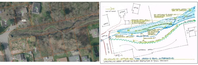
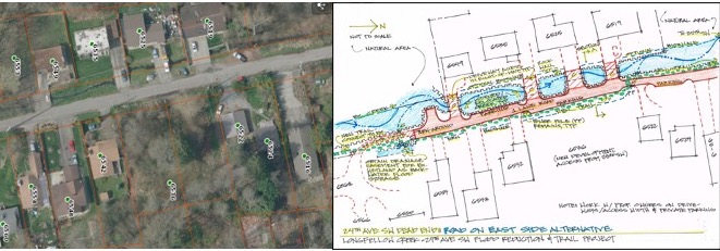
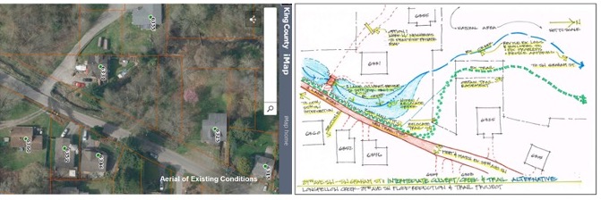
The community helped develop a preferred alternative for the project through developing and considering alternatives for the 3 sections of the project area:
The upstream (south) part of the project area is on Seattle Parks property. The Community’s preference is for the option with the biggest restoration potential — which involves moving the trail to one side of the stream, removing a small footbridge, and allowing the stream to re-connect to its floodplain.
For the street, the community selected a preferred alternative that would keep the stream in approximately the same location, but with a wider stream channel, and driveway culverts large enough for the stream to pass under.
At the very south end of the project, the stream would be given more room, and the trail clearer wayfinding.
Now, Mid Sound is working with city agencies to make sure that the designs can be permitted before embarking on full design details for the selected design.