Point No Point Estuary Restoration
Background on Point No Point Estuary
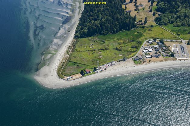
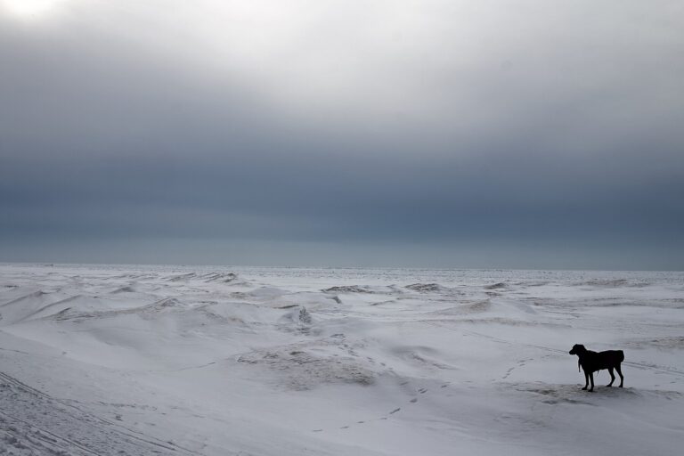
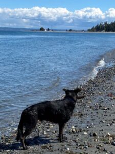
Point No Point is located in a beautiful and dynamic area near Hansville, in Kitsap County. The county park is a beloved local recreation area that holds layers of historic and current significance.
Point No Point was historically a tidally-influenced salt marsh fed by a small stream. The lighthouse is the oldest standing lighthouse in Washington. When it was built in the late 1800s, the marsh was diked and became a freshwater marsh. Today it is still freshwater, with a tide gate installed to keep saltwater from entering.
Mid Sound is working with Kitsap County, local tribes, natural resource agencies, and the surrounding community to study the opportunity to restore this area back to critical salt marsh habitat. Together, we are exploring options to return tides and fish to the marsh, address problems caused by the existing tide gate, and develop a multi-benefit project for salmon and the community.
Scroll down to review our evolving list of Frequently Asked Questions…
Exploring Restoration Potential
Mid Sound, Kitsap County, and various partners have been exploring the opportunity to restore salt marsh since a 2016. That’s the year a report on nearshore restoration opportunities ranked this site a #1 out of a list of 420 potential projects in Kitsap County in benefit to salmon. Not only is estuary habitat in Kitsap critical for salmon from the entire Puget Sound, but this project has the potential to be one of the largest restoration projects.
With funding from several state grants, coastal engineers have been working to collect data to answer key questions about whether restoration is possible. At the same time, we have been asking community members what their highest priorities and biggest concerns are about a potential restoration.
This process continues into 2024. So far, most of the data and models have shown that restoration could be possible. However, there are still questions that haven’t been answered.
One of the biggest questions remaining is whether this restoration project could help address some of the flooding and stormwater issues in the neighborhood. Could restoring the estuary help the community be more resilient to large storms and rising sea level? Are there opportunities to expand the project to include filtering stormwater?
In the winter, Point No Point road is frequently flooded, as are some of the neighbor’s homes. While all of the data so far indicates that restoring the estuary won’t make anything worse, we haven’t had the funding to look at whether there are opportunities to actually reduce the flooding.
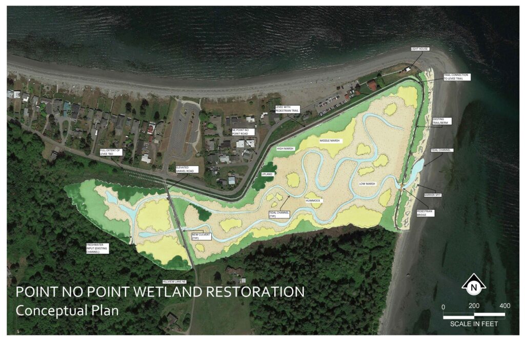
This is a conceptual restoration plan for Point No Point, showing one example of what restoration could look like. Many details are still to be determined through engineering, data collection, and partner input.
We are pleased that Kitsap County was recently awarded funding to do an analysis of stormwater in the neighborhood. We are hopeful that this process will help answer these important questions.
At this time, no one yet knows whether Point No Point can once again be a salt marsh. All we can do is to keep asking questions, and looking for the answers.
Learn more about nearshore habitat restoration and its importance to salmon and the Puget Sound ecosystem here!
Community Engagement This Spring
C
Coming Soon…
Fishtales
Mid Sound is happy to announce FISHTALES, a new quarterly outreach opportunity and collaboration
with individuals, neighbors & small groups making a big difference in the watersheds of North Kitsap County.
With its first episode planned for Tuesday, July 16 (6:30-6:30pm), we hope you’ll plan to join in quarterly to hear the good news. We’ll feature neighbors modeling shore friendly practices and gardeners who’ve learned to work with the salt and the sand. We’ll share updates on Point No Point, Rose Point and the chain of small projects that together make a big difference in supporting fish migration and a sense of place.
Submit your literary gems and film clip ideas here … we look forward to sharing one with every episode.
And we’ll be looking for your good news stories ( like the Orca gathering at Point No Point, and the kick-off of construction of the Estuary Restoration at Rose Point in Eglon ! ),
and the real people you see investing in strategies that improve coastal reslience & salmon habitat locally.
Click here for the link to tune in Tuesday, July 16 from 6:30-7:00.
And as you wander Point No Point throughout the month, you can share your observations here!
Updates
Stay In Touch
Resources
Past Meeting Notes
January 27, 2022
February 24, 2022
March 31, 2022
April 28, 2022
May 25, 2022
June 30, 2022
July 28, 2022
August 25, 2022
September 29, 2022
October 27, 2022
December 8, 2022
February 9, 2023
October 2023
Frequently Asked Questions
Community Meetings are on pause in 2024 while the County conducts a basin-scale stormwater assessement.
The County will be sharing what they learn during this phase of feasibility.
Look for Mid Sound’s publicly advertised Interpretive Beach Walk in late 2024, to celebrate interpretive elements in the Park once they are in place.
Mid Sound will work with anglers, tribal members and community volunteers in 2024 to tell the story of the history of Point No Point – the sense of place and cultural significance, and the story of scientific study so far.
A lot of behind the scenes work was done in 2023, but formal Community Meetings were more limited, and focused on sharing new data.
Hansville Community members and the larger Kitsap public were invited to formal meetings on February 9 & October 24, 2024.
Neighborhood meetings were held with affected adjacent landowners in July & October 2023.
More informal drop-in outreach was offered monthly in 2023; time to bring ideas or concerns to the table and help monitor the estuary. We enjoyed late afternoon Tea & Tides indoors on second Mondays, and early morning walks – Fourth Friday Fishing For Answers each month, too.
- Look to the charcoal panel on the R side of this page.
- Find February 9, 2023
- Click on Agenda, Slides, Notes + Q&A to review the content of the meeting.
- Click on the PDF version of the King Tide Presentation, altered to include limited descriptions for context.
- – This is the Presentation that was given to attendees by Jessica Cote of Blue Coast Engineering.
- – The slides contained in this presentation address the King TIde event of Dec 27th & flooding as they relate to the Estuary Restoration Project.
- Look to the charcoal panel on the R side of this page.
- Find August 25, 2022
- Click on the PDF version of the Data Presentation, altered to include limited descriptions for context.
- – This is the Presentation that was given to attendees by Jessica Cote of Blue Coast Engineering.
- – The slides it contains are not easy for the layperson to understand, but they are a best attempt to give landowners the visual descriptions needed to feel safe and to keep learning.
- Our website does not support the size and type of animations used in the slides, so until a recording can be posted, this is the next best option.
- Download the Q&A to read along with the Presentation. These questions and answers were dictated from the recording.
- – Each question is listed next to the Slide Number that inspired the question.
- – Hopefully this document will help walk you through the presentation. You can record your own follow up questions on the FAQ sheet, and use this to inform an email to our Project Manager: lisa@midsoundfisheries.org.
- – Your follow-up questions will be routed to the person who can provide an answer, and will be added to an updated version of this Q&A sheet for others to review.
Thank you for your time and interest in the Point No Point Estuary Restoration Project.
This project will restore habitat to the marsh, which is critical for salmon and other species, and has been lost in the Puget Sound to development.
Our feasibility study looked at the coastal processes and conditions needed for a successful and sustaining tidal reconnection on the east shore and confirmed we have the right conditions to continue developing this design.
- – To the South, feeder bluffs support Point No Point’s Beaches.
- – The marsh has been heavily altered, but can provide critical habitat for a diversity of species with restoration.
- – Driftwood is an important part of a healthy functioning estuary, and the East Beach has lots of it!
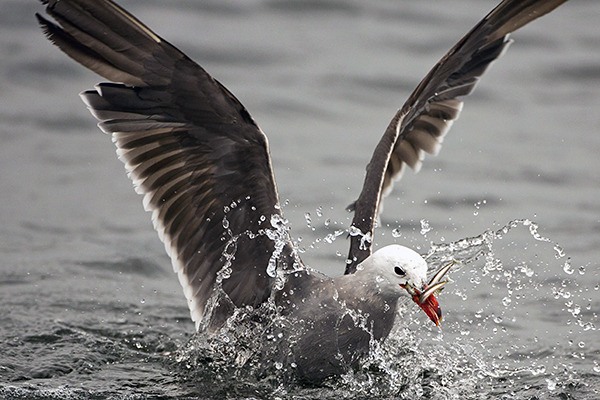
- – Point No Point is a critically important birding area. We have the partnership of Kitsap Audubon and area wildlife biologists to ensure the project supports birds as well as fish and the human population adjacent to the property.
We are looking next at the interior of the marsh to understand and address water flows and habitat needs.
Estuaries are fascinating and unique places. You can explore estuary restoration projects all around the Sound. Visit the pages below – or plan a field trip – to see for yourself!
Carpenter Creek Salt Marsh & Estuary in Kingston, WA
Nisqually estuary at the Billy Frank Jr. Nisqually National Wildlife Refuge
Other projects that longtime residents may be aware of have looked at the marsh from a variety of perspectives, been driven by different funding interests and goals, and with different data to work with. Coastal Engineering technology has made a lot of strides in the past ten years. Individuals in decision-making roles at the County have changed over time, and the political will was different even when Mid Sound entered the picture than it is in 2023. The latest science surrounding outmigrating juvenile salmon, nearshore habitat, coastal resilience strategies, and climate and ocean conditions all factor into why a project is ranked as highly as POint No Point for restoration and for restoration funding at a given time in history.
Yes! Juvenile Chinook use estuaries up to 34miles from their natal streams. Point No Point is 18 miles from the Snohomish and 29 miles from the Stillaguamish rivers, as well as others.
We know the juvenile salmon do not run straight to sea but travel all around the Sound after they leave the rivers, and surveys found ten times more juveniles inside estuaries than in the shorelines next to them.
Our goal is not to restore a salmon spawning run in this estuary, as there is not the flow or historic population for that here. By restoring the natural processes that support the food web, we design for a future in which system-wide efforts build stocks of wild fish. In the meantime, hatchery fish require habitat, as do forage fish and the great diversity of species salmon rely upon in the nearshore. There are also resident cutthroat trout in the Hillside stream that may use the marsh and access to the Sound once restoration is complete.
We’re happy to report, there is no IF. There really is no question: juvenile salmon do find other (non-natal) estuarine habitats once they leave their natal stream/river; wild and hatchery fish do this all the time during their outmigration to the Pacific Ocean (e.g., Hayes et al. 2019. https://afspubs.onlinelibrary.wiley.com/doi/full/10.1002/mcf2.10098).
Outmigrating Juvenile salmon operate differently than adults seeking a natal stream: they aren’t looking for a particular estuary. Any sheltered, brackish nearshore place with lots of food will do. We know that entering estuaries is worth the risk to juvenile salmon because they continue to use them. If it didn’t work we’d only see a few misguided individuals using these habitats, and there is a large body of evidence that the opposite is true.
The Marine Survival Project is the best resource we know for data about the use of estuaries in the Salish Sea.
Scientists are also monitoring the biological responses to dike removal in the restored Nisqually Delta. Fish diversity is sampled using beach seining and fyke trapping, and otolith (i.e. fish ear bones) sampling is used to measure salmonid growth and residence times. Early indications are that the resilience of the historic ecosystem is returning. The removal of dikes and reconnection of more than 35 km of tidal slough systems and floodplains has increased salt marsh habitat in the southern reach of Puget Sound by 55%. And the studies indicate that juvenile salmon have benefitted from the dike removal. Continued monitoring will allow managers and scientists to detect subtle changes within the delta as the system acclimates to tidal flows.
For more about wild fish, see Beamer et al 2003. For more about hatchery fish, James et al 2023 another good place to start.
The point of estuary restoration is that more estuary habitat equals more places for juvenile salmon to shelter and grow, meaning that more will get big enough to avoid predation as juveniles, more will end up in the ocean, and more will return to spawn as adults. There is no scenario in which less estuarine habitat increases survivorship of Puget Sound salmon as a whole.
The data supporting ecosystem-wide benefits when natural processes are restored is strong, too. With regard to fish, specifically:
(1) Outmigrating juvenile fish will be able to enter and make use of the habitat if the estuary is reconnected to tidal exchange. The usage of the interior of pocket estuaries being more heavily used then the exterior beach by juvenile salmon has been well documented at existing pocket estuaries in Island County and Skagit County (Beamer et al 2006). The full restoration design scenario is based on existing intact estuaries within Puget Sound and based on measurements and some new research by WDFW (in draft and will be available in early 2024) showing most of the fish move during tidal exchange. Stranding in existing pocket estuaries has not been identified as a concern by fisheries biologists in Puget Sound.
(2) Current conditions prevent all but a nominal percentage of fish, primarily cutthroat trout which have been documented in the stream that enter the marsh to return to the Sound via the tide gate and continue their life cycle.
The few fish that do enter the marsh via the tide gate currently have one shallow ditched channel in which to “be”, in which to seek food, and shelter. There is one super-highway that predators use for stalking their prey. And there is one temperature and salinity level available to any and all fish species, throughout the four seasons.
With reconnection of the historic estuary to Puget Sound the cutthroat trout population will be able to move freely into and out of the estuary.
Restoration will introduce complexity to the salt marsh in terms of depth, sinuosity, shade, and the large woody debris that creates hiding places. Channels in restored estuaries are engineered based on research of sizing tidal channels to be large enough to prevent scour and empty with the tide in areas reached by the incoming tide. Fish adapted to natural tide cycles seek water of appropriate depth and temperature.
Fish and other animals do now and will continue to end their life cycles in the marsh, but whether they are eaten by a predator, or they die and become nutrients for other fish, or they make it out to sea and return to spawn in rivers to the South of Point No Point this is a natural process.
If the marsh is restored to tidal influence, cool clear water will flush the marsh twice a day, This will invite healthy dissolved oxygen, a diverse food web, and variable topography and salinity which are protective factors not present in the existing marsh condition. In these systems there is also a gradual slow inflow of cool groundwater so there is shallow water constantly seeping into the interior channels and out through the primary tidal channel during all phases of the tides in these systems, but particularly important at low tides.
According to the biologists monitoring the restored estuary at Carpenter Creek, Juvenile chinook will definitely turn up in a restored PNP estuary. They have in Kingston. And, data from Paul Dorn’s beach seining with Stillwaters in the very early post-restoration period suggested that many were hatchery stock from Miller Bay. Providing habitat for these fish, in particular, supports the industry. And to the extent that scientists agree their presence in the system is relieving predation pressure on wild fish (sufficiently to overcome any downside from competition with wild fish) their use of a restored Point No Point Estuary will support orcas and non-native human fisheries.
Residents can visit Kitsap County’s website to view the critical areas included on their properties or within Point No Point. This is done by clicking on the link below, then going to Parcel Viewer. Under “Choose a theme”, select “Critical areas”, then look at the legend tab to see what each color and pattern represents.. You can select your own parcel in real time to view critical areas, and move the map with your cursor to view nearby properties including Point No Point Park.
This phase of design – specifically looking at groundwater and surface water data, and modeling existing condition – is showing us how a restored salt marsh that actually drains twice a day may also address the unrelated flooding residents experience along Point No Point Road. Data collection continues to model water movement above and below ground, inside and outside of the marsh, in present and potential future scenarios. We will continue to share what we find.
As for septic systems, this is both a groundwater and surface water issue. The groundwater model will show us if there are any increases in the groundwater table as a result of restoration. At this point the hydrogeologists have indicated the groundwater table should be lower after restoration, but we are modeling it to confirm this understanding. While we hope to decrease the volume of the surface water and groundwater on the North side of the road, our primary responsibility is to not increase it above the existing condition. As long as we are not increasing the groundwater or increasing the surface water conditions, we will not change the conditions for the septic systems. Our responsibility to not negatively impact any septic systems above existing conditions.
Our engineer is bound by a professional code of ethics to do no harm. From the County’s perspective, the chosen Preferred Alternative design will need to take into account not only flooding concerns, but impacts to the county’s infrastructure and long term maintenance obligations. If the Preferred Alternative improves conditions on the N side of the project footprint (outside of the scope of the project), this will of course be viewed as an asset.
The Federal Emergency Management Agency (FEMA) and the National Flood Insurance Program (NFIP) have prepared Flood Insurance Rate Maps (FIRM) (2017a) and a Kitsap County Flood Insurance Study (FIS) (2017b) that provide flood elevation return intervals for the eastern Kitsap Peninsula. The Base Flood Elevation (BFE) (subject to inundation by the 1% annual chance flood) along Point No Point is mapped as elevation 13 feet NAVD88 (14.8 feet MLLW). If a property falls within the BFE then they are required to pay into NFIP.
The property owners along Point No Point Road whose homes sit at or below this elevation will continue to pay into the National Flood Insurance Program. None of the restoration design alternatives change the elevation of homes north of the estuary, and the proposed alternatives will be designed according to permitting standards.
If the tide gate is removed and salt water inundation is restored at the site, the predicted flooding for the FEMA BFE extends further inland, approximately 1.5 ft higher than the 100-year extreme water levels calculated based on the Seattle tide gauge because it also includes wave run-up. Permitting standards require the proposed levee be designed 2 ft higher than even this high Base Flood elevation.
Wave run-up does not penetrate into the marsh as far as Hillview Lane. And Hillview residents are protected by their elevation. Restoration does not change that, but it will address flooding by draining the marsh twice a day once the estuary mouth on the Eastern boundary is open to tidal exchange.
Our engineer conducted a review of the potential FEMA flood map changes the project could incur for the homes in the uphill area of Hillview Lane and found that the project will not change the flood risk or maps for these homes.
The flooding that users of Hillview Lane currently experience will not be increased with restoration; the County will not sign off on a design that increases flooding, and our Engineer is bound by a code of ethics to do no harm. In the spring of 2023, the process of choosing a Preferred Alternative – the size, shape, and elements of the design – will help determine how integral Hillview becomes to the overall final design.
Mid Sound, Blue Coast, and the County will be in conversation with the Hillview community as we explore these steps. For instance, several Hillview residents have expressed an interest in taking care of the wetland – an interest, too, in protecting fish in the fresh water system, and concern for the Clean Water Act. Any Preferred Alternative that is chosen will include best practices to protect habitat and abide by the Clean Water Act as enforced at the County level for critical areas. Critical areas within the project site include wetlands currently degraded by invasives, and a creek currently degraded by multiple barriers to fish passage, and lacking the connectivity that could allow for flushing. Depending upon the footprint included in the chosen Preferred Alternative, the design may or may not be funded to raise Hillview Lane, addressing long-term maintenance of the road, and providing free-flowing water for the wetland and any fish that may pass through it from Hillview properties. Time and continued analysis will tell.
The marsh will become a more dynamic and productive place: we will have native plants instead of the present invasives, a variety of heights and shapes to the terrain, more natural and productive stream channels, and the daily changes of the water levels with tidal flushing. The salt marsh plants will be lower to the ground than existing plants, but we will also explore a variety of plantings on the edges and higher elevations to increase diversity.
The alders at the southwest corner of the marsh will be evaluated as we develop that area of the design further. At this time there are no plans to remove trees, or plant anything taller than is there now. Depending on the extent of the marsh design, some of the lowest alders may not adapt to the salt water – we will explore and evaluate that before we finalize our design. The alders uphill along the stream bank would be out of the area of change. We do not anticipate altering the conifers along the south edge of the marsh.
Yes. The current conditions & problems will get worse over time. A lot of what we are talking about would address several climate change scenarios, and make the area more resilient to climate change, particularly that N Beach enhancement, and there needs to be a pathway for the water to go. The ditch channel is very unstable. In nature, creeks are sinuous, and have a stable configuration including flood plains. The channels now have caved in and become blocked. We consider future scenarios in everything we do. The levee height and possible future conditions model is conceptual. It was built for the meeting to demonstrate what a levee and tidal channel and an opening would allow in terms of management and drainage; something that is not happening right now.
We are currently building a groundwater model and we can use this model to predict the groundwater elevations relative to any drinking wells and predict if there will be any changes to the ground water in those wells as part of restoration. With this model we can run several scenarios including extreme events which would include sea level rise to look at future potential impacts to groundwater as well.
Environmental Review
Mid Sound will be required to submit application for permits (if we receive funding for Final Design & Construction), not the County. If you’re not familiar, a JARPA is submitted for this kind of project, most likely a Nationwide Permit (NWP). We have quite some time and several milestones and decision points to clear before that time, but will work with our engineering team at Blue Coast to compile the data we have collected during the Preliminary Design phase, and we will be required to respond to The Army Corps, WDFW, Ecology, our Suquamish & S’Klallam Tribal partners among others with scheduled site visits, and follow-through throughout the review period.
NWPs are a type of general permit issued by the Corps on a nationwide basis for activities having minimal impacts. The NWPs are proposed, issued, modified, reissued (extended), and revoked from time to time, after the opportunity for public notice and comment at the Headquarters level in Washington DC. It’s sort of like a fast-track for projects that meet all the terms and conditions. They do not include Environmental Impact Statements, as these are generally reserved for actions significantly affecting the quality of the human environment. The County will have reviewed the reports by the end of 2023 that determine project viability, so if we get to the permitting stage, the Final Design will not significantly affect the quality of the human environment (except, we hope, for the better). Public comment will be scheduled once the County has reviewed reports this spring… likely sometime in the summer. Dates will be made public once Mid Sound, Blue Coast & the County know more about the timeline of emergency management at PNP.
According to our contact at the Corps, if we seek a nationwide permit for the Point No Point Estuary Restoration, an interested party may provide comment to the Corps directly. Mid Sound will be happy to share the contact number for whomever our regional Army Corps reviewer happens to be at that phase of the project, so that parties who are compelled to do so have a clear path to commenting.
The existing freshwater marsh is not in good condition – the restoration will actually improve habitat for other species. There may be a few that do not transition to the salt marsh habitat, but overall most species will adapt and can thrive in the more diverse and functional ecosystem we are supporting with this project.
We are working with experts and partners at agencies and conservation groups to make sure we are accounting for the habitat changes in our design. Once the Preferred Alternative has been chosen (spring 2023), we can do a wildlife survey of the footprint, and take the steps to design a habitat that supports most. We will be employing monitors, and reporting our findings in later phases of the project, too.
The salt marsh in neighboring Kingston has noted some interesting changes in the distribution of native birds with restoration. The pre- and post-construction data collected there on Carpenter Creek marsh provides an important local model of how important thoughtful observation at each and every stage of restoration truly is.
The late June bloom and July seeds observed in a restorative planting of native sedges, grasses and rush can provide a more diverse menu to those unique migratory birds that we see – and hope to see – in the Point No Point marsh.
There are a number of projects that have been done with regard to converting fresh water marsh to salt water. Overall the results show us that there is generally an increase in diversity of animals and birds and plants – species that use those habitats.
In Puget Sound we are lacking in salt marsh habitat, which is the impetus for this project.
Data indicates that the displacement of some freshwater species is not the ecological disaster for Kitsap birds that the loss of estuaries, historically, has been and continues to be.
We will need to write a biological assessment (NOAA, WDFW, Audubon will review) to convince regulatory agencies that we are making a net positive impact. The protections for existing species are part of the construction process. Mid Sound works with biologists to minimize disturbance during the construction of projects like this; species that do not instinctively flush out with the presence of human activity are carefully moved up- or downstream of the active project footprint.
We will be replacing invasive, non-native plants with plants that were part of the original habitat here. This will increase habitat and food productivity for insects, aquatic animals, birds, and mammals. The design calls for various heights and vegetation types around the marsh, and we will continue to assess the habitat needs and share our design updates. We are talking with the tribes about their interest in native plant harvesting at the site, and talking with wildlife experts about the best habitat and invasive plant strategies to use to support all kinds of wildlife in the Park.
There will be no changes to the public access of the beach or Park as part of this project. We hope to improve the road-side access for pedestrians into the Park, and perhaps explore some additional trail or boardwalk options later in design.
At high tide, there will be a wider area under water where the beach and the marsh meet. Visitors may need to use the marsh trail to cross this area at high tide. We will explore the exact location and size of the outlet, as well as bridge or boardwalk options for crossing it, in the next design phases.
Though outside of our original scope, we’re hoping to make a positive impact to the North Beach as well. The data sharing by individual property owners has helped us come to this idea. When we do beach enhancement it’s a combination of sand and large woody debris and vegetation. We work with a landscape architect to maintain recreational opportunities and have a vegetation plan to stabilize the beach. In terms of erosion, we allow for a certain amount of adjustment of a beach, and we do wind wave and beach profile changes over time. We over nourish in order to allow our beach to adjust. Maintenance plan would be discussed with the County to come to a plan for the Preferred Alternative. Healthy drift cell without blockages, and sediment supply is good.
Our project is focused on habitat restoration in the marsh, but we know that the surrounding area is an important part of the project’s success. We are speaking with residents in the area to understand the frustrations they are feeling with the park, and relaying this information back to our land management partners. Wherever possible we would like to help address these issues, but some will be larger than our project can address.
Yes, we have shared our information and listened to feedback from over 30 groups already, and will be continuing these conversations throughout the design process. We have spoken to natural resources and cultural staff from the Suquamish, Port Gamble S’Klallam, Jamestown S’Klallam, and Skokomish tribes, and the Point No Point Treaty Council. We are seeking their partnership for their expertise, the significance of the site for cultural and treaty rights interests, and as partners for stewardship of the area. They are supportive and excited for the project to develop.
We are working with Kitsap County departments including Public Works, Parks, and Community Development as well as other local agencies and representatives, conservation and interest groups. We have broad support for this project, and are receiving helpful information and perspectives from all of these partners.
We have connected with members of the communities around the Park, and will continue to seek their feedback and share our project developments with them. Each community has its own priorities and interests in the area, which we are listening for and seeking how we might be able to address them.
As you enjoy your walk you can monitor what you see with eBird. This is an app that allows you to report what you see.
We would love to find other ways like forage fish surveys if you were interested. Please email us at restorePNP@midsoundfisheries.org.
We are in communication with Kitsap County department staff to develop a maintenance plan and budget. Our definition of a successful project includes long-term maintenance and monitoring, and we will work with our partners to come up with a plan for this.
No, Kitsap County is the landowner and steward of the marsh area. The boat ramp/parking lot is outside of our project area. However we are working with WDFW for their input on habitat on the project, as well as to keep apprised of the parking lot and boat ramp developments. Where possible, we are looking for ways to partner with the various land managers in the area to improve our project and existing conditions.
Design will continue for another two years, pending funding. Permitting can take up to a year, and there is a limited construction window where we will have the least impact on species while in the marsh. We are estimating construction in 2025 or 2026 at the earliest, but there are many design and funding steps ahead, and as such, actual construction window is a moving target. Construction itself will move pretty quickly – just a couple of months.
During construction, parts of the Park, including the beach and parts of Hillview Lane and Point No Point Road, will need to be closed for safety. However this time will be limited. This level of detail will not be developed for some time, but given how important the park is in different ways for different people, Mid Sound will be looking for a contractor to communicate scheduling clearly, and stage construction in such a way as to minimize the time that areas are closed.
We will continue our outreach as project updates and funding are available.
Keep checking this website for project updates and our events page! You can also email us and ask to join our email update list for announcements and invitations to future outreach events.
Please take our survey!
We love volunteers! And we know so many folks want to support this project and care for Point No Point. We are looking for ways to have volunteers help with:
- – Data collection and surveys, try eBirds
- – Public education and outreach
- – Invasive plant removal
- – Native plant plantings
- – Long-term monitoring and stewardship
Or, you can join us at any of other work parties happening around King and Kitsap County! Please email us to hear when these events may be scheduled.
History of the Point No Point Project
Feasibility and Feedback
Mid Sound and Blue Coast Engineering began the Feasibility Phase of design for the project in June 2021 with funding from the Salmon Recovery Funding Board. Blue Coast analyzed the physical conditions to confirm our embayment estuary restoration will succeed. Mid Sound connected with over 40 partners and 40 neighbors to discuss our project goals, share the feasibility results, and listen to the interests and concerns of others who love this Park too.
Recent History
We received grant funding from the Estuary and Salmon Restoration Program and the Salmon Recovery Funding Board to continue outreach and data gathering efforts to better understand how to balance salmon habitat restoration with infrastructure needs and concerns. In Nov 2021, we installed 4 groundwater monitoring wells around the marsh, and Community Meetings were held monthly to share technical information, and hear from the public and our partners. In August 2022 the first set of data from these borings received Community & Partner review. In 2023, data analysis continued, and coastal engineers used the data to run models for how the estuary could function. We received feedback from the public, from other scientists, and from our funding partners in late 2023. A report to the funders on the work thus far will be provided in late spring 2024.
What's Next
Mid Sound’s current phase of funding is wrapping up. While we have learned a lot about the site, we still haven’t answered enough questions to confidently state that the project is feasible.
The next phase of the project will be led by Kitsap County. They have received funding to do a stormwater analysis, and assess whether restoration would create a more resilient community, better protected from strong storms and high tides.
We are working with many great partners, funders, and invested parties on this project, including: